
It may seem as if winter already has a firm grip over the eastern U.S., but the cold air that's about to make a plunge into the Northern Plains will take this year's level of cold to a new level.
We are talking about bitter cold. Dangerously cold windchills. The possibility of frozen pipes. Record cold temperatures broken (which is tough to do during what is already the coldest time of year). And to double down, some of these frigid temperatures will impact many who could potentially be without power due toWinter Storm Fern.
(MORE:Major Winter Storm Targets South and East)
Here's a look at where all the cold temperature records could occur through the weekend.
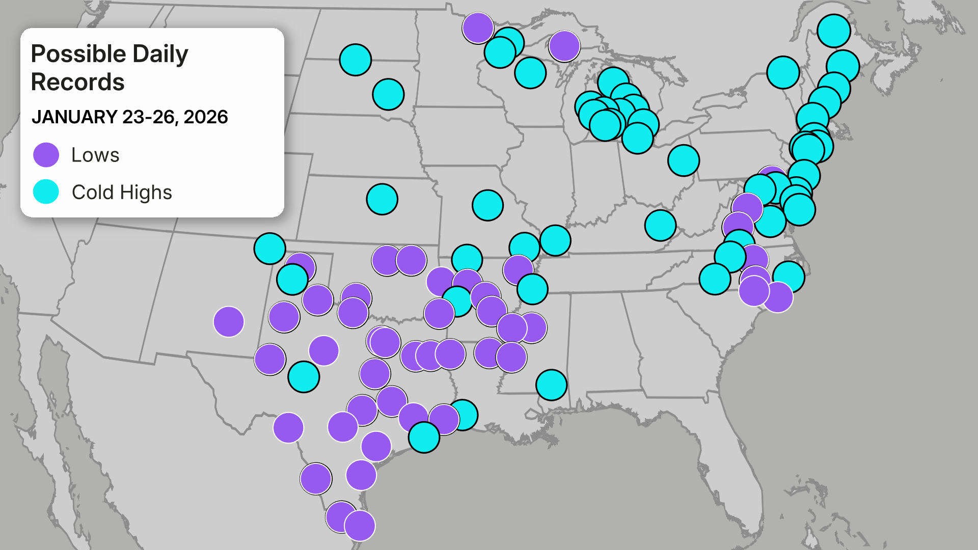
We will break it down by regions:
Plains And Midwest
The cold air first arrives in the Plains and Midwest. While the last few weeks have already been extremely frigid, we are about to get even colder.
Low temperatures will drop to 15-30 degrees below zero from the Dakotas to Michigan.
That's the actual temperature.
The "feels like" temperatures, or the wind chills will drop to 35-50 degrees below zero in some places.
The peak of the cold will last from Thursday to Saturday.
Even places like Sioux City, Iowa and Chicago will face wind chills as low as 25 degrees below zero. However, places like Duluth and Fargo will feel close to 50 degrees below zero.
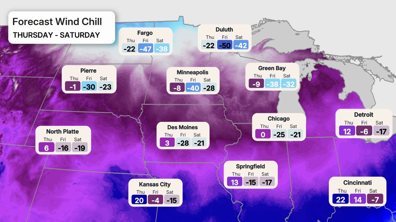
Hibbing, Minnesota could set a record low on Saturday of 35 degrees below zero.
The National Weather Service in Duluth is describing this as "life threatening cold."
By Sunday, temperatures finally "warm" a little, however, it will still be extremely cold.
Deep South
As the cold reaches the South this weekend, it will be ushered in by Winter Storm Fern.
Not only will lows be in the teens and 20s for much of this region, the winter storm could leave millions in the dark due to power outages from the forecast ice potential.
This means many could face dangerously cold temperatures with no power.
(MORE:5 Things To Know About Ice Storms)
Wind chills in the South are forecast to drop into the single digits (or even below zero) on Sunday morning for places like Dallas, Oklahoma City, Little Rock and Austin.
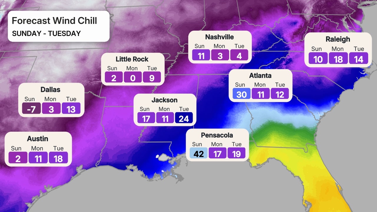
We could see record lows on Monday morning stretch from Texas to Mississippi, and highs won't make it above freezing for several days.
The National Weather Service office in Dallas issued a strong warning about the potential for widespread pipe damage due to the prolonged cold.
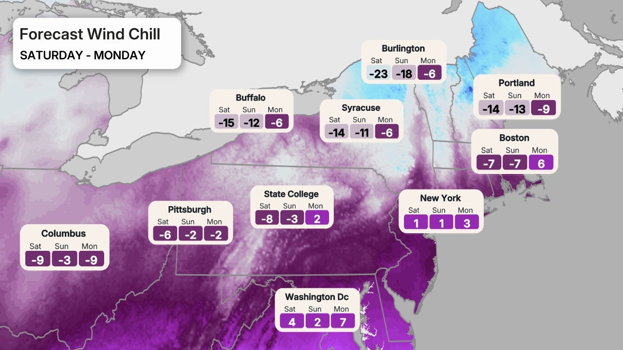
The Northeast
Yes, the cold will spill eastward as well, bringing temperatures that will even make the hearty New Englanders shiver.
The brutal cold will bring temperatures as much as 15 to 20 degrees below average for the Northeast.
Interior portions of the Northeast and northern New England will face the coldest temperatures. Lows will drop below zero from Upstate New York to northern Maine, with the wind making it feel even colder.
Big cities along the I-95 corridor will see temperatures drop to the teens and single digits Saturday and Sunday mornings, with wind chills as low as 10 degrees below zero.
Jennifer Grayis a weather and climate writer for weather.com. She has been covering some of the world's biggest weather and climate stories for the last two decades.
Post a Comment